 Scramble up gully to Scafell Masstiff Ridge
30 April 98
Day 16
Scafell Pike
Distance 8 Average speed low mph
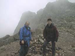
Three of us Brian Higbee, Don Phillips and I, set off for the summit at 09:15 along the track from the National Trust car park towards brown tounge at the rear of R&FCC mountain hut. The path is well signed and has been well constructed having been reopened in 1986. This well defined path continues up to the start of the scree when the going get really steep and loose a little further up and it becomes a scramble to the ridge. By this time we where in the cloud and from here to the summit the visiblity decreased to less than 10 yds as can be seen in the summit photo. The photos where taken with a Epson PC600 digital camera. The return trip was quicker but tended to pull muscles we did not know we had.
During the afternoon we worked on the web site and surprisingly for a small hotel in the back of beyond Wasdale Head Hotel had a pay telephone setup which included a data line and standard phone socket, for use with a credit card enabling us to forward the recently completed web pages with ease.
Scramble up gully to Scafell Masstiff Ridge
Both climbers at the top on the ridge
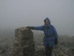 The author at the top of Scafell Pike!!
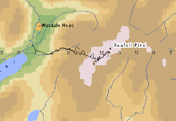
Route in black as downloaded from the GPS!!
Day -8 -1 Start 2 3 4 5 6 7 8 9 Snowdon 11 12 13 14 15 Scafell Pike 17 18 19 20 21 22 Ben Nevis 24 25 26